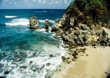
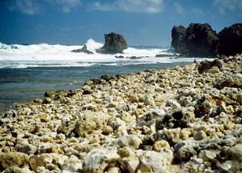
The wild east coast of Barbados has been battered and shaped by the Atlantic waves crashing along the shoreline. The beaches on the east coast provide a cooling breeze and are popular for walking, surfing and beachcombing.
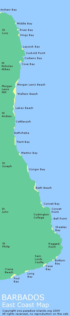
Barbados east coast beaches and places of interest (North to South)
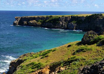
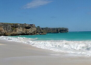
Archers Bay: Archers is technically on the north west tip of Barbados; at the point where the wild Atlantic meets the calmer Caribbean side.
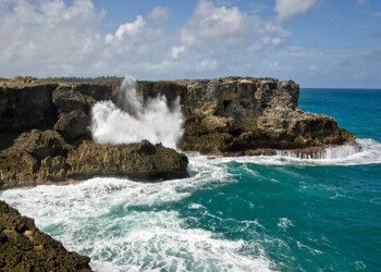
North Point: North Point marks the tip of the island separating the northern shore with the east coast. A sharp pointed and wild protrusion of rock which is constantly battered by the Atlantic Ocean.
Animal Flower Cave: Located just east of North Point (see above); Animal Flower Cave takes it's name from the sea anemones in the cave pools. Some of the pools in cave are deep enough for swimming with spectacular sea views from the cave openings.
|
|
|
|
|
Archers
|
North Point
|
The first cove on the northernmost east coast is Middle Bay (difficult to access) leading down to...
River Bay: The River Bay area is popular with locals for picnics and is quite often busy on the weekend. There is a small freshwater stream running down to the cove which gives it's name. Facilities include changing rooms with showers, picnic benches and some shade.
To the south of River Bay lies Kings and Laycock.
Little Bay: Located just between Laycock and Cuckold Point, Little Bay is noted for it's magnificent blowholes just offshore and a small and safe pool carved out of the rock by the waves which ideal for swimming. To the south lies Corbens.
Cove Bay: Like River Bay (above) this a popular picnic spot for locals which is not easy to reach and involves driving through a field.
Morgan Lewis Mill: Maintained by the National Trust of Barbados, the Morgan Lewis Mill is the only restored sugar mill in Barbados.
Walkers Beach: Located in the Parish of St Andrew; Walkers Beach is a wide expanse of fine sand and popular for beach combing.
|
|
|
|
|
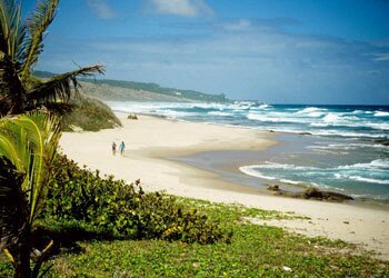
Lakes Beach
|
Cattlewash
|
|
Lakes Beach: Joining up with Walkers Beach (see above) it is possible to walk from Lakes right up to Morgan Lewis for some fabulous wild Atlantic scenery.
Cattlewash: It is said that Cattlewash derived it's name from the cows bathing in the sea. The area is popular with locals and well known for health resorts with it's fresh breezy climate.
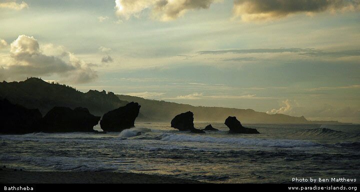
Bathsheba: Bathsheba is a wild and beautiful part of the island and probably the most well known landmark on the east cost of Barbados. Perfect white beaches and striking rock formations make Bathsheba a must see for any visitor.
Tent Bay: Tent is the home of a small fish market and a number of local fishing boats are based at the cove. Also at Tent is the Victorian Atlantis Hotel which is famous for it's Sunday buffet. There once a railway that linked Tent Bay with Bridgetown which was built in 1881 and trains ran regularly until the railway was closed in 1937.
|
Martins Bay: Martins is a small fishing village which famous for lobster catches, great scenery and rock pools ideal for swimming at low tide. It once had a station for the Victorian railway that ran from Bridgetown along the east coast of Barbados. To the south lies Congor Bay.
Bath Beach: Bath is one of the few safe places on the east coast of Barbados for swimming and bathing; hence the name "Bath Beach". Surrounded by Casuarina trees, Bath has a large car park, picnic area and public changing rooms. |
|
|
|
|
Ragged Point
|
Bottom
|
Conset Bay: Located in St John, Conset is found off a steep winding road. It has a jetty and the cove is used by a fee local fishermen. To the south lies Skeetes Bay which is again utilised by a few local fishermen and is difficult to find.
Culpepper Island. The tiny Culpepper Island lies off Ragged Point (see below) and can be reached on foot at low tide.
Ragged Point: The east coast lighthouse located at Ragged Point provides fine views of the rugged east coast. Known as the East Point Lighthouse, this austere structure is one of four lighthouses on Barbados (the others are at Needhams Point, South Point and Harrison Point).
Turning the corner at Ragged Point there are the more sheltered beaches and coves along the south eastern and south coast of Barbados including Bottom, Cave, Long and Foul bays; together with landmarks and well know hotels including Sam Lords Castle and the Crane Beach Hotel.
See also our Barbados West Coast overview and travel guide.
|
|
Caribbean travel, holiday, vacation and cruise guide to Barbados. All text and photographs are Copyright Paradise Islands org
|
|
|
|
|
|
|
|
|
|
|
Interactive Satellite Image
Use the "+" or "-" buttons to zoom in or out
|
|
|