| Sint Maarten Map | Saint Martin Map |
|
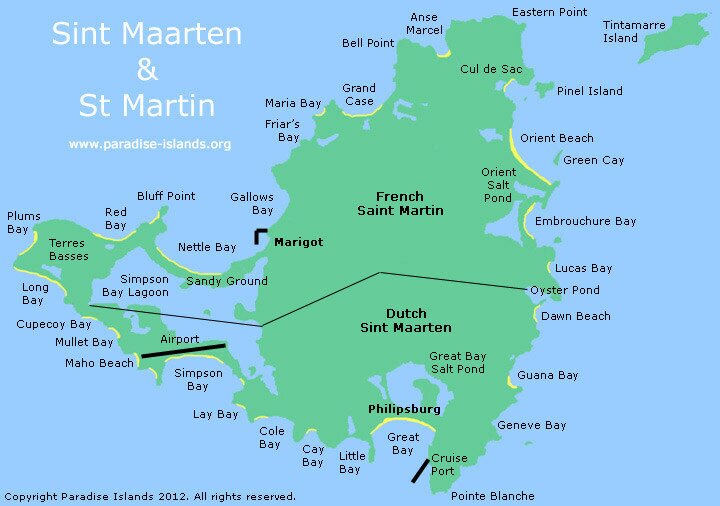
The island was divided in half in 1648 by the 'Treaty of Concordia' agreement. The northern part belongs to the French (Saint Martin) and the southern part belongs to the Dutch (Sint Maarten) and forms part of the Netherlands Antilles.
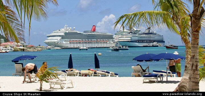
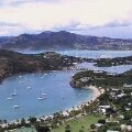
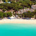
The Dutch occupy 13 square miles in the south. The Dutch capital Philipsburg is a popular stopover with cruise lines and tourism forms the bulk of the island's economy. English is widely spoken on the Dutch side of the island and although the official currency is the Netherlands Antilles Florin, US dollars are widely accepted in all the stores in Philipsburg.
The French part of the island (known as the "Collectivite de Saint-Martin") occupies the northern section of the island capital Marigot. The French area is around 20 square miles of the total island area and with a population of 35,000. Before 2007 the French area formed part of Guadeloupe as a "commune" or overseas region of France and was part of the European Union. In 2007 it became a separate overseas collectivity of France with neighbouring St Barthelemy.
|
|
|
|
Interactive Satellite Image
Use the "+" or "-" buttons to zoom in or out
|
|
|
|
Want to use this Sint Maarten / Saint Martin map (top of page)? Paradise Islands grants permission for this map to be copied or downloaded for personal use, school projects, within blog entries or travel forum posts without requesting permission from the copyright owner (please place a courtesy link to this site or this page, thank you). We do not grant permission for this map of Sint Maarten to be used for general and commercial website illustration.
Map copyright Paradise Islands Caribbean Travel Guide. All rights reserved.
Print this map? Click this link for the JPG file (720 x 506 pixels): Sint Maarten Map (opens in new window)
Link to this page? Please use this page URL: http://www.paradise-islands.org/st-maarten/map.htm
Link to the JPG file? http://www.paradise-islands.org/st-maarten/images/Sint-Maarten-Map.jpg
|
|
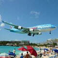
Princess Juliana Airport final approach!
|
Philipsburg beach
|
| Travel, holiday, vacation & cruise guide to the Caribbean. All text and images are Copyright Paradise Islands org. All images on this website are obtained with the permission of the owners and come from various sources including tourist boards. |
|
|
|
|
|
|
|
|
|
|
|
Cruise Port Guide
|
|
|
|
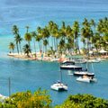
Philipsburg
|
|
|
|
Airport Maho Beach
|
|
Some of our favourite
Caribbean destinations
|
|
|
|
Old San Juan
Puerto Rico
|
|
|
|
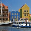
Willemstad
Curacao
|
|
|
|
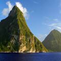
The Pitons
Saint Lucia
|
|
|
|
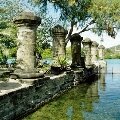
Nelson's Dockyard
Antigua
|
|
|
|
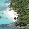
Tobago Cays
Grenadines
|
|
|
|
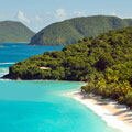
Trunk Bay
St John USVI
|
|
|
|
Shirley Heights
Antigua
|
|
|
|
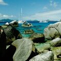
The Baths
Virgin Gorda BVI
|
|
|
|
West Coast
Barbados
|
|
|
|
Buried Plymouth
Montserrat
|
|
|
|
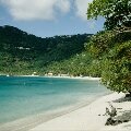
Cane Garden Bay
Tortola BVI
|
|
|
|
Necker Island
BVI
|
|
|
|
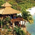
Marigot Bay
St Lucia
|
|
|