|
|
|
Cruise Port Guide
|
|
|
|
| Jost Van Dyke Travel Guide |
|
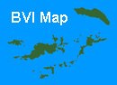
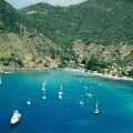
| Welcome to Jost Van Dyke (JVD) on the Paradise Islands website. The small island of JVD is just over 3 square miles (2,000 acres) with 150 permanent residents in the idyllic BVI group. Situated a few miles north west of Tortola and a 20 minute ferry ride from West End which brings you to the main settlement of Great Harbour which features many Caribbean restaurants and a few shops. |
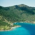
| Great Harbour is outlined by a reef offshore and steep hillside dotted with colourful houses. The Bay is nearly always bustling with visiting yachts and JVD is one of the most popular day trips from the main island of Tortola. |
|
|
|
|
|
|
|
Little Harbour
|
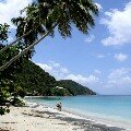
White Bay
|
Great Harbour
|
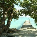
Boat Dock
|
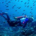
Scuba Diver
|
|
|
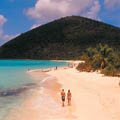
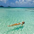
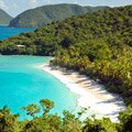
Notable landmarks on JVD include the wonderful white sandy beach at White Bay. Here you will find restaurants and gift shops, a small hotel and a bar.
The beach at White Bay is good for swimming, snorkeling or just relaxing in your own personal hammock and can be reached from Great Harbour by water taxi (but beware you have to wade ashore at the other end). |
|
The other side of Great Harbour you will find Little Harbour with it's beach and restaurant serving local dishes. On the other side of the island is the very pretty Diamond Cay where you will discover the Bubbly Pool which at certain tides becomes a natural salt water Jacuzzi.
Just off shore from Diamond Cay are the islands of Little Jost Van Dyke, Green Cay and Sandy Spit ("spit" meaning a small patch of sand in the middle of the sea) and just around the headland is Sandy Cay.
|
|

|
| Interesting facts: The isle of Jost Van Dyke was named after a noted Dutch Pirate (Joost van Dyk) and the Virgin Islands were first discovered by Columbus in 1493; although Columbus did not stop here or name JVD. The popular local drink called the "Painkiller" was invented at the Soggy Dollar Bar in White Bay. Painkillers consists of rum, pineapple, coconut and orange juice. Notable residents have included William Thornton, who was born on the island in 1759, and later went on to become the architect of the US Capital Building. The island is somewhat laid back and has only had mains electricity since 1991. |
| Travel, vacation and cruise guide to JVD and the Caribbean. All text and images are Copyright Paradise Islands org. All photographs on this Caribbean travel guide website are obtained with the permission of the owners and come from various sources including the islands tourist boards. Some of our own maybe reproduced with permission - please see notes attached to each image to avoid any copyright penalty |
|
|
|
|
|
|
|
|
|
Quick Facts
Main Town
Great Harbour
Language
English
Currency
US Dollar
Island Size
3 Square Miles
Population
150
|
|
|
|
British Virgin Islands
|
|
|
|
Tortola
|
|
|
|
Virgin Gorda
|
|
|
|
Necker Island
|
|
|
|
US Virgin Islands
|
|
|