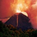
| The town of Plymouth was (and still is) the capital of Montserrat and is located in the south eastern part of the island which is now restricted by an exclusion zone following the eruption of the the Soufriere Hills volcano in 1997. |
Earlier in July 1995 the volcano erupted covering much of the town in a thick layer of volcanic ash. The town was clearly in danger and in December of 1995 the whole town was evacuated. Many of Plymouth's residents moved away from the island as the economy had been severely disrupted and there was not enough accommodation or work in the safer northern part of the island.
Early in 1996 the residents who had remained on the island were allowed back into the main town; which turned out to be a terrible mistake... |
|
This rare image taken by the Editor shows the main street a few years before the eruption buried the whole town
|
| In June 1997 a huge eruption occurred producing pyroclastic flows which claimed the lives of 19 people in Plymouth and the surrounding area and prompted the permanent evacuation of the town. Two months later, a four day period of intense eruptions and further pyroclastic flows in August of 1997 destroyed most of what was left of the town. All of the streets and buildings were permanently buried under and thick layer of volcanic lava, ash and rock. |
|
Government HQ
|
"Star of the Caribbean Road" gas station
|
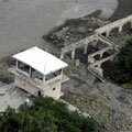
| As the seat of government, the main commercial centre and the only port of entry; the almost total destruction of the capital caused huge problems for the island. Even the island's W H Bramble airport, which was located on the other side of the Soufriere Hills volcano, was destroyed by a pyroclastic flow. |
Before the volcano activity the population of Montserrat was over 12,000; with many of the residents living in and around Plymouth. The population of the capital was 4,000 in 1995 and is now 0. Some two thirds of the total population of the island were evacuated, many never returned.
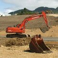
Today the island's population is around 5,000 and over half of the total area of the isle is covered under the exclusion zone and deemed too dangerous to redevelop. Reconstruction is taking place in the safer northern half of the island. |
|
Interactive Satellite Image
Use the "+" or "-" buttons to zoom in or out
|
|
|
| Travel, holiday, vacation & cruise guide to the Caribbean. All text and images are Copyright Paradise Islands org. All images on this website are obtained with the permission of the owners and come from various sources including tourist boards. |
|
|
|
|
|
|
|
|
|
|
|
Soufriere Volcano
|
|
|
|
Bramble Airport
|
|
|
|
Reconstruction
|
|
Some of our favourite
Caribbean destinations
|
|
|
|
Old San Juan
Puerto Rico
|
|
|
|
The Pitons
Saint Lucia
|
|
|
|
Willemstad
Curacao
|
|
|
|
Nelson's Dockyard
Antigua
|
|
|
|
Tobago Cays
Grenadines
|
|
|
|
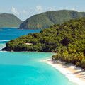
Trunk Bay
St John USVI
|
|
|
|
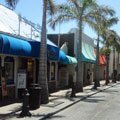
Philipsburg
Sint Maarten
|
|
|
|
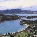
Shirley Heights
Antigua
|
|
|
|
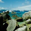
The Baths
Virgin Gorda BVI
|
|
|
|
West Coast
Barbados
|
|
|
|
Cane Garden Bay
Tortola BVI
|
|
|
|
Necker Island
BVI
|
|
|
|
Marigot Bay
St Lucia
|
|
|
|
El Yunque Rainforest Puerto Rico
|
|
|